Halo
Validation level: 5. CHI, UIST, CSCW and TOCHI paper publication
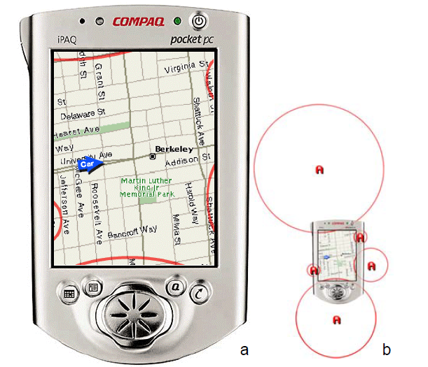
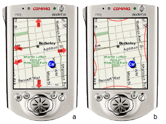
Halo is a visualization technique that supports spatial recognition by showing the location of off-screen objects. It uses rings that are large enough to reach into the border region of the display window. From the portion of the ring visible on-screen, users can infer the location of the object. It led to a significant timesaving and a higher satisfaction among the users, comparing to the arrow-based visualization technique.
Publications
Also featured in
Storyboard of Functions

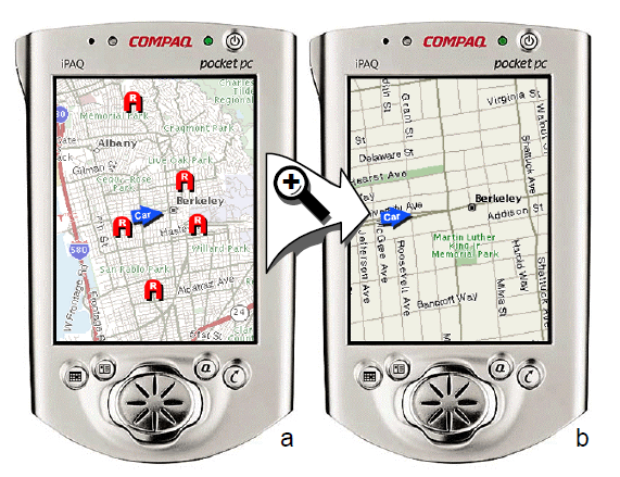
The problem found was that, in order to make route decisions, users need to see the alternatives. However, when drilling down to street information, relevant locations disappear into off-screen space.

Halo technique shows where in off-screen space the different interesting points are located. Each off-screen location is located in the center of a ring that reaches into the display window.

It compares the task completion time with other the Arrow interface technique and the results showed that Halo led to significant timesaving and higher satisfaction.
Limitations:
- Halo is susceptible to clutter from overlapping arcs. This is solved by merging the arcs into double arcs.